Urban Growth NSW’s 2016 North Eveleigh Plan exceeding allowable Floor Space Ratio (FSR)
2016 North Eveleigh development proposal is exceeding allowable FSR (Floor Space Ratio)
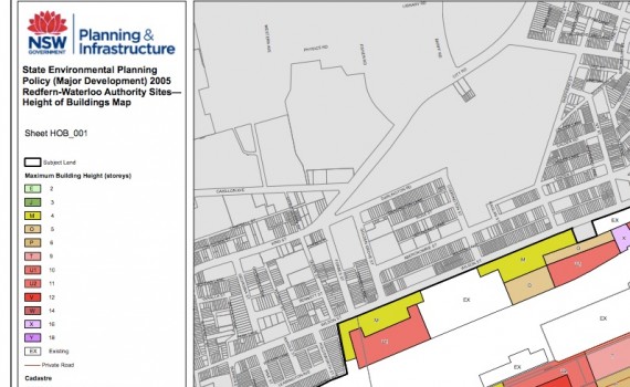
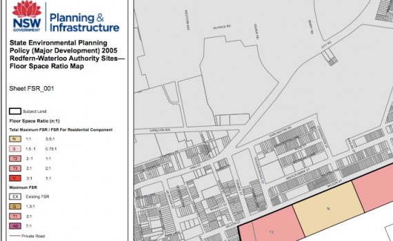
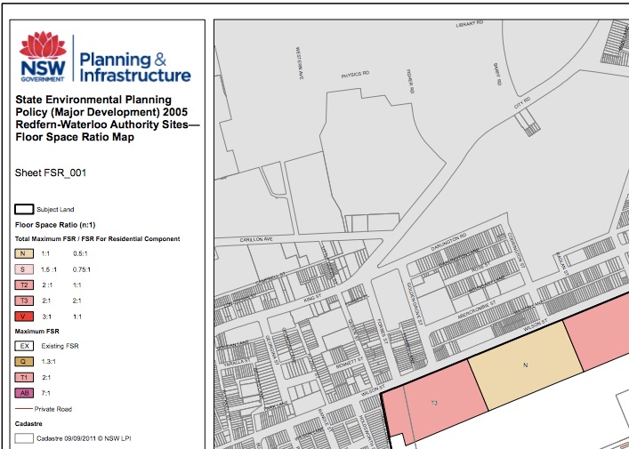
State Environmental Planning Authority 2005 Redfern Waterloo Map states a maximum FSR (Floor Space Ratio) of 2:1 is allowable in the Site.
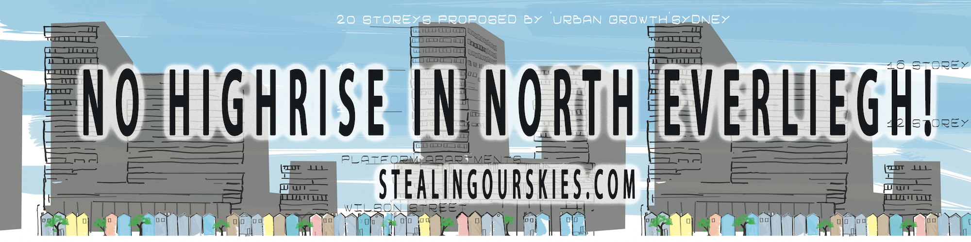
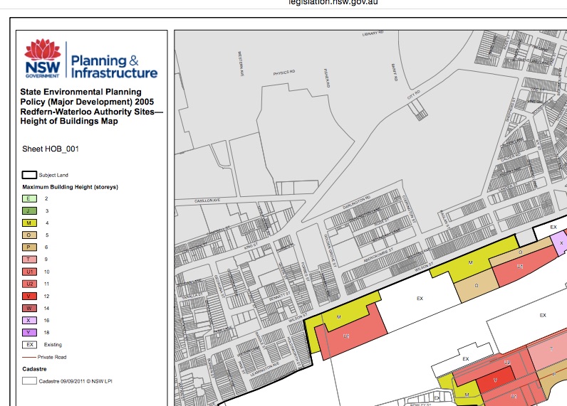
Not only is Urban Growth NSW’s current 2016 plan exceeding the permissible building heights for the area (which is 10 Storeys) they are also exceeding the allowable Floor Space Ratio for the buildings.
Allowable Floor Space Ratio = 2:1
Superlot 1 FSR = 6.2:1
Superlot 2 FSR = 5.4:1
Superlot 3 FSR = 2.7:1
calculations below
Floor Space Ratio defines the permissible physical size of development allowed on a piece of land.
A guide for calculations can be viewed in this PDF here supplied by planning.nsw.gov.au. Height and Floor Space Ratio PDF
The FSR Calculation is defined as Gross Floor Area / Site Area
- “Site Area” is the size or area of the Lots upon which the buildings will be built. (does not include areas such as parks, walkways and public streets/roads)
- “Gross Floor Area” (GFA) is the area of internal walls within each floor of a building. (does not include such areas as stairwells and Lift shafts, Ventilation Ducts)
North Eveleigh West Superlots Site Area.
Allowable FSR = 2:1
Proposed GFA 57000 m²
SuperLot A 4000 m²
- Storeys 20 – 4 – 16
- GFA = 24800 m²
- FSR = 6.2:1
SuperLot B 4700 m²
- Storeys 20 – 4 – 14
- GFA = 25500 m²
- FSR = 5.4:1
SuperLot C 2500 m²
- Storeys 3 – 4
- GFA = 6800 m²
- FSR = 2.7:1
As noted below there is a subclause in the Legislation (State Environmental Planning Policy (State Significant Precincts) 2005) that says the Building Height and FSR restrictions only apply where the minister for planning has not approved a Concept Plan. Until it is approved it is ILLEGAL. In other words he/ she can overrule the legislated restrictions.
It looks like it is up to us as a community to prove to the minister that good planning is NOT:
-
HIGH POPULATION DENSITY (506 people per hectare / 1600 residents within a 3.1 hectare precinct)
-
ILLEGAL BUILDING HEIGHTS (20 Storey Building Heights where 10 is legislated as the Max)
-
ILLEGAL FSR (up to 6.2:1 in an area legislated as 2:1)
-
POOR ONISTE TRAFFIC (one point of entry and roads crossing public thoroughfares)
-
INSUFFICIENT OPEN SPACE ( 0.32 ha Public Park for 1600 new residents)